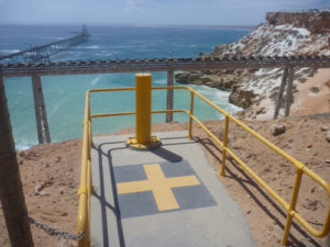
 24 Durlacher St, Geraldton
Surveying
Hille, Thompson & Delfos has expanded and employs Cadastral, Engineering and Mining Surveyors enabling the Practice to diversify our survey service. Below is a brief description of our fields of practise.
Hille, Thompson & Delfos has expanded and employs Cadastral, Engineering and Mining Surveyors enabling the Practice to diversify our survey service. Below is a brief description of our fields of practise.
 Subdivisions, both rural and urban, are guided through the various stages from initial feasibility, rezoning if necessary, design and WAPC application (see our Town Planning Section) to the field survey and lodgement of the registered Plan. This process then allows for the issue of new titles arranged by a Solicitor or Settlement Agent.
Boundary identification or Repegging involves re-surveying in accordance with historical Survey records and we provide an Authorised Surveyor’s Certificate and repeg sketch demonstrating any improvements and their relativity to the boundaries.
Strata subdivisions to enable disposal of individual units in duplex or multi-unit development are dealt with under the Strata Titles Act.
Easement surveys are documented to allow reciprocal Grants of Easements for various purposes such as access, water rights and pipelines over other persons land and required to be registered legally on their Title.
Other Land Surveys are carried out on a contract basis for such Authorities as the Dept of Lands, Ministry of Housing, Dept of Minerals & Petroleum and Local Govts.
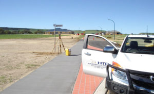
The initial setting out and working control as well as the final “as constructed” plans for roads, earthworks, drains, sewers or other services are familar tasks. Typically we support and manage Machine Guidance operations for our earthmoving clients.
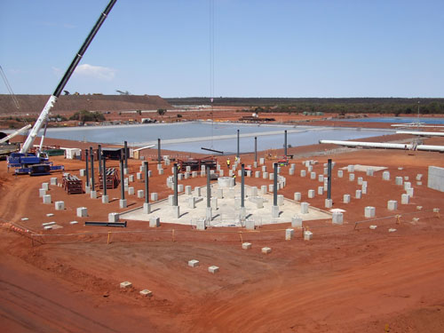
The Practice continues to be involved in projects requiring the setting out, controlling and checking of buildings, footings, holding down bolts, machinery and complex construction assemblies including bridges and marine structures.
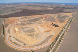
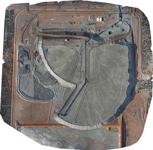
A variety of Departments and Authorities continue to seek our assistance in the provision of detailed plans to show existing natural or manmade features together with vertical heights and contours. For larger open sites we utilise our UAV to undertake contour surveys.
Architects, Drafters and Builders also request similar detailed plans for project design.
Mineral claims and leases are pegged out, details registered with the respective Mining Registrar for the area, and any necessary Mining Act compliances arranged.
Formal Tenement Surveys for Mining Titles are undertaken for both the Mining Companies and the DMP.
Exploration surveys including gridding & Drill Hole setout, Mine Development surveys including Borefield, Mine Infrastructure, Pit layout and Road networks setout are all types of work we have experience in.
Our range of GPS equipment is an efficient tool in most of this type of work.
Utilising our own UAVs we can undertake small scale aerial photography projects suitable for open area contour surveys, changed environment monitoring, large stockpile volume calculations, project timeline monitoring, infrastructure capture. The UAV affords a safe and efficient tool to capture sites where access maybe an issue or restricted due to heavy machinery operations.
Establishment of horizontal and vertical survey control stations together with any other survey connections as required for large scale mapping and construction projects. These maybe in conjunction with specialist photogrammetric companies to provide plans and details at pre-determined scales for Mining, Infill Sewer, Defence and major Project design.
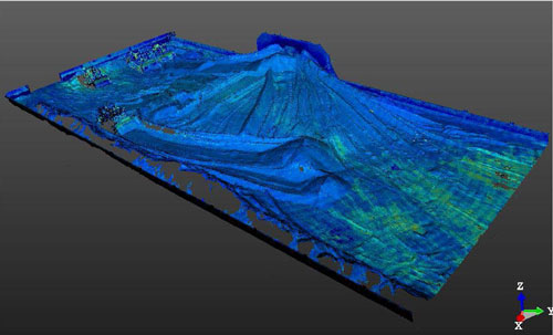
We undertake regular measurement and calculations of volumes of stockpiles of various materials to monitor production quantities, stock movement, progress on earthworks etc. Large outside stockpiles of Mineral Ore, Salt and sands are now typically surveyed using our UAV in a safe and efficient process.
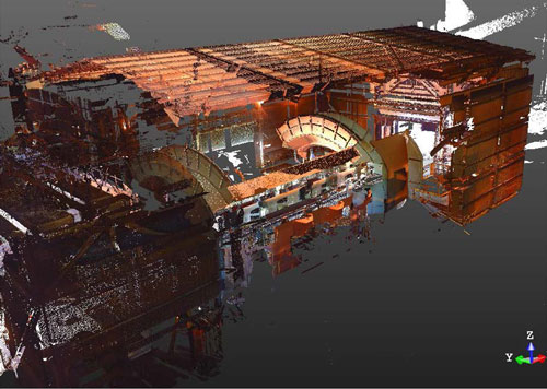
Using our 3D Laser Scanner we can scan structures for dimensional control during maintenance replacements or monitoring deformation of structures over time.
We also use the scanner for volumes of stockpiles in sheds and particularly when it is often not so safe to venture onto the stockpiles themselves.
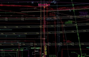
We maintain databases for Clients in graphical form keeping record of infrastructure both above and below ground.
This graphical representation forms the basis for our clients GIS database where they can maintain layered information about maintenance schedules, standards and sizes etc.